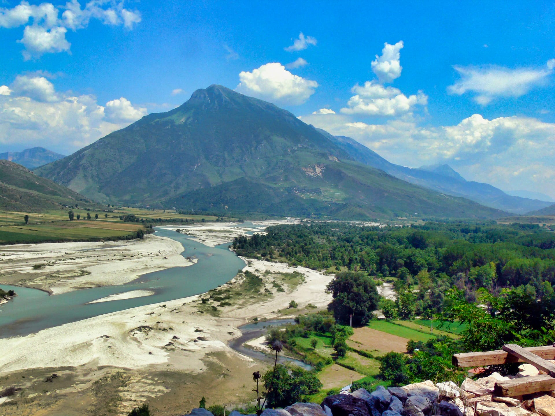
Albania’s River Basin Geography
Albania’s rivers originate primarily in the eastern mountain ranges (Albanian Alps, Korab Mountains, Pindus) and flow west toward the Adriatic and Ionian Seas. The territory divides into three main river basins:
Drin Basin (northern Albania, approximately 11,800 km²): Includes the Drin River and its tributaries (including Buna River connecting to Lake Shkodër). The basin drains the Albanian Alps and provides most of Albania’s hydroelectric power through the Drin cascade (Fierza, Komani, Vau i Dejës dams).
Seman Basin (central Albania, approximately 5,600 km²): Formed by the confluence of Osum and Devoll rivers, draining central highlands and agricultural plains before reaching the Adriatic near Fier.
Vjosa Basin (southern Albania, approximately 6,700 km² in Albania): The Vjosa flows from Greek mountains (where it’s called Aoös) through southern Albanian valleys, entering the Adriatic near Vlorë. This remains Europe’s last major undammed river.
Smaller coastal rivers (Ishëm, Mat, Shkumbin, Erzen) drain directly to the Adriatic, while southern rivers (Bistrica, Drinos) flow through valleys before joining larger systems or reaching the Ionian Sea.
Major Rivers: Characteristics and Tourism
Vjosa River (Vijosë)
Length: 272 kilometers total (approximately 80km in Greece as Aoös, 192km in Albania) Source: Pindus Mountains, Greece Mouth: Adriatic Sea (Narta Lagoon area near Vlorë) Status: Europe’s first Wild River National Park (designated March 2023)
The Vjosa flows freely without dams on its main channel (though tributary Drinos has small dam), creating braided river channels, gravel islands, and natural flooding patterns increasingly rare in developed Europe. The river supports endemic fish species, otter populations, and important riparian ecosystems.
Tourism Activities:
- Whitewater rafting (Class II-III rapids, April-June high water season, €39-109 per person)
- Swimming and riverside camping (July-September lower water)
- Fishing (permit required, seasonal regulations)
- Access primarily from Përmet, Tepelenë, and Selenicë
The 2023 national park designation aims to protect the entire river corridor while managing increasing tourism. Conservation groups celebrated this as major European river protection achievement, though implementation and enforcement remain developing.
Drin River (Drini)
Length: 285 kilometers total (portions in Kosovo, Albania, North Macedonia) Albanian Section: Approximately 175km from Kosovo border to Adriatic Major Tributaries: White Drin, Black Drin Dams: Fierza (500 MW), Komani (600 MW), Vau i Dejës (250 MW)
The Drin is Albania’s longest river and most important for hydroelectric generation—the three-dam cascade produces approximately 70% of Albania’s electricity (around 4.5 TWh annually). The dams created large reservoirs:
- Fierza Reservoir: 73 km², created 1978
- Komani Reservoir: 12 km², created 1985 (also called Koman Lake)
- Vau i Dejës Reservoir: 25 km², created 1971
Tourism: The Komani Lake ferry (3 hours through canyon, €10-15) serves both local transport and tourism, connecting to Shala River valley and providing access toward Valbona. The reservoirs themselves see limited recreational use beyond the ferry service.
Osum River (Osumi)
Length: 161 kilometers Source: Tomorr Mountain area Notable Feature: Osumi Canyon (Kanioni i Osumit)
The Osum carves a 26-kilometer gorge near Çorovoda in central Albania, creating canyon with vertical walls reaching 70-100 meters. The canyon offers:
- Canyoning: Technical descent through gorge requiring wetsuits, ropes, guides (€40-70 per person)
- Swimming: Natural pools in calm sections (summer low water)
- Hiking: Canyon rim trails and river-level paths (varying difficulty)
The canyon sees growing tourism but remains less crowded than northern Alps destinations. Access from Berat (40km) or Çorovoda village.
Shala River
Length: Approximately 30 kilometers Access: Boat-only from Komani Lake (no road access to valley)
The Shala flows through remote northern valley, joining the Drin at Komani reservoir. The valley’s isolation (until recent decades, only pack trails reached it) preserved traditional architecture and limited development.
Tourism: Boat tours from Komani Lake (1-2 hours each way, €25-30 per person) bring visitors for swimming, lunch at riverside restaurants, and valley scenery. The cold turquoise water (snowmelt-fed) and boat-only access create appeal, though July-August sees crowding (200-300+ visitors daily).
Mat River
Length: 115 kilometers Notable Feature: Treni Gorge (upper section) Economic Importance: Hydroelectric dams, irrigation
The Mat flows from mountains east of Burrel through central Albania, reaching the Adriatic north of Durrës. The upper section cuts through Treni Gorge offering whitewater potential (less developed than Vjosa), while lower sections support agriculture in the Mati plain.
Shkumbin River
Length: 181 kilometers Historical Significance: Traditional north-south Albanian dialect division
The Shkumbin crosses central Albania west from Lake Ohrid region, historically marking linguistic boundary between Gheg (northern) and Tosk (southern) Albanian dialects. The river valley provided ancient trade route, though current tourism focuses elsewhere (Ohrid area, coastal regions) rather than the river itself.
River-Related Activities and Tourism
Rafting and Kayaking
Albanian rivers support whitewater rafting primarily April-June when mountain snowmelt creates higher flows:
- Vjosa River: Class II-III rapids, full-day trips from Përmet (€39-109 including transport, guide, equipment)
- Osum River: Class II-III in Osumi Canyon, half-day to full-day trips (€40-70)
- Mat River: Limited commercial rafting, potential for development
Kayaking requires personal equipment or rental (limited availability)—most river tourism uses guided raft trips rather than independent kayaking.
Swimming and River Recreation
Summer low water (July-September) allows swimming in calm pools and beach areas along most rivers. Popular swimming locations include:
- Vjosa River near Përmet and Tepelenë
- Osum pools in Osumi Canyon
- Shala River valley (boat access)
- Various mountain streams in Albanian Alps
The water is cold (10-18°C) even in summer from snowmelt sources, limiting swimming duration for most visitors.
Fishing
Albanian rivers support trout (introduced brown trout, some native species), carp, and other species. Fishing requires permits (obtainable from forestry offices or national park authorities), and regulations vary by location and season. Enforcement is inconsistent—check current regulations before fishing.
River Conservation and Environmental Challenges
Albanian rivers face competing pressures:
Hydroelectric Development: Numerous small hydropower projects proposed or under construction on tributaries and smaller rivers. While large dams exist on Drin system, pressure continues for additional exploitation of remaining free-flowing rivers beyond Vjosa.
Pollution: Agricultural runoff (fertilizers, pesticides), untreated sewage from riverside towns, and industrial discharge affect water quality in some sections. Rivers generally cleaner than heavily industrialized European waterways but facing degradation from development.
Gravel Extraction: Illegal or poorly regulated gravel mining from riverbeds disrupts ecosystems, changes flow patterns, and damages spawning areas for fish.
Tourism Pressure: Growing river tourism concentrates visitors at popular sites (Vjosa rafting zones, Osumi Canyon, Shala River), creating localized impacts including erosion, litter, and disturbance to wildlife.
The Vjosa Wild River National Park designation represents major conservation achievement, though effective protection requires adequate funding, staffing, and enforcement—all challenging in Albania’s limited-resource context.
Seasonal River Characteristics
River conditions vary dramatically by season:
Spring (April-June): Snowmelt creates high water, strongest flows, best rafting conditions, cold water (8-12°C), occasional flooding in low-lying areas. Rivers appear brown/gray from suspended sediment.
Summer (July-September): Lower flows, clearer water, warmer temperatures (12-18°C), exposed gravel bars and beaches, optimal swimming conditions, reduced rafting (insufficient water in some sections).
Autumn (October-November): Flows increase with autumn rains, temperatures cool, colors change in riverside forests, shoulder season for river activities before winter.
Winter (December-March): High flows from rain (low elevation) and snow accumulation (high elevation), cold temperatures, most river activities suspended, some rivers flood agricultural areas.
Planning river-based activities requires considering seasonal water levels and temperatures—spring offers whitewater excitement but cold conditions, summer provides swimming opportunities but lower flows.
Albania’s Rivers in European Context
Albania’s river systems remain comparatively undeveloped:
Advantages:
- Vjosa is Europe’s last major wild river
- Cleaner than many Western European rivers
- Less commercialization and development
- Lower prices for river tourism
- Combination of mountain streams and coastal deltas in compact area
Disadvantages:
- Limited tourism infrastructure compared to developed river destinations (Rhine, Danube tourist routes)
- Inconsistent water quality monitoring
- Developing conservation enforcement
- Language barriers in remote areas
- Limited rescue/safety infrastructure
For visitors seeking river experiences without heavy tourism development, Albania offers opportunities increasingly rare in Europe, accepting trade-offs of basic services and emerging river tourism sector.