Albania’s Geographic Diversity
Albania occupies 28,748 square kilometers of the western Balkans, bordered by Montenegro, Kosovo, North Macedonia, and Greece, with 427 kilometers of coastline along the Adriatic and Ionian Seas. The compact size allows traveling from mountain peaks to Mediterranean beaches within 2-3 hours, creating unusual geographic diversity accessible for short-term visitors.
Approximately 70% of Albania is mountainous, with the Albanian Alps (northern Albania), Korab Mountains (eastern border), and Pindus ranges (south) creating dramatic topography. The highest peak is Maja e Korabit (2,764 meters) on the North Macedonian border, though the most iconic mountains are the Albanian Alps including Maja Jezercë (2,694 meters) and the peaks around Valbona and Theth valleys.
Between mountains and coast lie river valleys, agricultural plains, wetlands, and the ancient lakes (Ohrid, Shkodër, Prespa) that provide biodiversity hotspots and water resources. This geographic compression means Albania contains Mediterranean, continental, and alpine climate zones creating habitat diversity supporting varied flora and fauna within small area.
Mountain Landscapes: The Albanian Alps and Highland Regions
The Albanian Alps (Bjeshkët e Nemuna—Accursed Mountains) in northern Albania near the Montenegro border provide the country’s most dramatic mountain landscapes. Limestone peaks rise 2,400-2,694 meters creating sharp ridges, glacial valleys, and karst features including caves and underground rivers. The region includes:
- Valbona Valley National Park (8,000 hectares): Mountain valley at 800m elevation with Valbona village as base, Valbona-Theth hiking trail
- Theth National Park (26,630 hectares): Remote valley accessible via rough road from Shkodër, containing Theth village and Grunas Waterfall
- Maja Jezercë (2,694m): Highest peak in Albanian Alps, requiring technical climbing skills to summit
The mountains support beech and pine forests at lower elevations, alpine meadows above treeline, and limited wildlife including brown bears, wolves, lynx, and chamois (though sightings are rare for casual visitors). The region sees tourism development focused on Valbona and Theth, with increasing visitor numbers creating infrastructure pressures.
Central highlands include Mount Dajti (1,613m) near Tirana accessible via cable car, providing easy mountain access from the capital. The Korab range (east) and Tomorr massif (south-central) offer additional mountain terrain seeing less tourism than the Albanian Alps.
Rivers and Canyons
Albania’s rivers flow from mountain sources toward the Adriatic and Ionian Seas, creating gorges, canyons, and valleys. The major rivers include:
Vjosa River (300 kilometers in Albania): Flows from Greek border to Adriatic, designated as Europe’s first Wild River National Park in March 2023. The river remains free-flowing (no dams on main channel), supporting rafting, fishing, and river tourism based from Përmet. The national park designation aims to protect the river ecosystem while managing tourism growth.
Drin River (285 kilometers total, portions in Albania): Northern Albania’s largest river, dammed to create hydroelectric reservoirs including Komani Lake—a 34-kilometer reservoir where ferries transport tourists through canyon scenery toward Valbona Valley.
Osum River: Carves Osumi Canyon near Çorovoda (central Albania), offering canyoning and river swimming in narrow gorge with vertical walls reaching 70-100 meters.
Shala River: Remote northern valley accessible only by boat from Komani Lake, known for turquoise water and riverside restaurants serving boat tour visitors (May-October seasonal access).
Albanian rivers generally remain cleaner than many European rivers due to lower industrial development, though agricultural runoff and untreated sewage affect water quality in some areas. Conservation efforts focus on maintaining free-flowing rivers and protecting riparian ecosystems.
Lakes and Wetlands
Albania contains three major natural lakes plus smaller mountain lakes and coastal lagoons:
Lake Shkodër/Skadar (368-530 km² seasonal variation, largest lake in Balkans): Shared with Montenegro, supporting wetland ecosystems, pelican colonies, and fishing communities. The Albanian portion sees less tourism than Montenegro’s developed lakefront, offering opportunities for boat tours and birdwatching from Shkodër.
Lake Ohrid (358 km², 288m maximum depth): Ancient lake (1-5 million years old) shared with North Macedonia, hosting endemic species including Ohrid trout. Albania holds eastern shore centered on Pogradec town, while North Macedonia’s western shore contains UNESCO World Heritage historic core (Ohrid old town, Saint Naum Monastery).
Lake Prespa (254 km² total, shared Albania-North Macedonia-Greece): High-elevation lake (853m) with transboundary national park protecting wetlands and endemic species. Albanian side sees minimal tourism compared to Ohrid.
Karavasta Lagoon (4,380 hectares): Coastal wetland in Divjakë-Karavasta National Park hosting 250-300 Dalmatian pelican breeding pairs (5% of global population), 228 recorded bird species, and important Adriatic Flyway migration stopover.
Mountain lakes include glacial tarns in the Albanian Alps and volcanic lakes like Lura Lakes (north-central Albania), though these are small (less than 1 km²) compared to the major lowland lakes.
Coastal Features: Albanian Riviera and Beaches
Albania’s 427-kilometer coastline divides into Adriatic coast (north, generally sandy beaches and coastal plains) and Ionian coast (south, rocky coves and the Albanian Riviera). Key coastal features include:
Albanian Riviera (SH8 highway, Vlorë to Sarandë, approximately 130 kilometers): Coastal route crossing Llogara Pass (1,027m) then descending to Ionian beaches including Dhërmi, Himara, Jale, and Ksamil. Tourism development concentrated 2000s-present creates mix of resort infrastructure and remaining undeveloped beaches.
Karaburun Peninsula: Roadless peninsula forming western boundary of Vlorë Bay, accessible only by boat. Karaburun-Sazan Marine National Park (12,570 hectares, established 2010) protects Mediterranean marine biodiversity including sea turtles, dolphins, and over 300 fish species.
Beaches: Ranging from developed resort beaches (Dhërmi, Jale, Ksamil) to accessible public beaches (Borsh’s 7-kilometer pebble beach) to remote boat-access coves. The beaches are predominantly pebble/rocky rather than sand (some sand exists at Ksamil, Durrës), with clear water and moderate development compared to neighboring Mediterranean coasts.
Coastal ecosystems face development pressure as tourism grows—construction, pollution, and seasonal visitor surges affect beach quality and marine environments, creating tension between economic development and conservation.
Caves, Springs, and Karst Features
Albania’s limestone geology creates extensive karst features including caves, sinkholes, and springs:
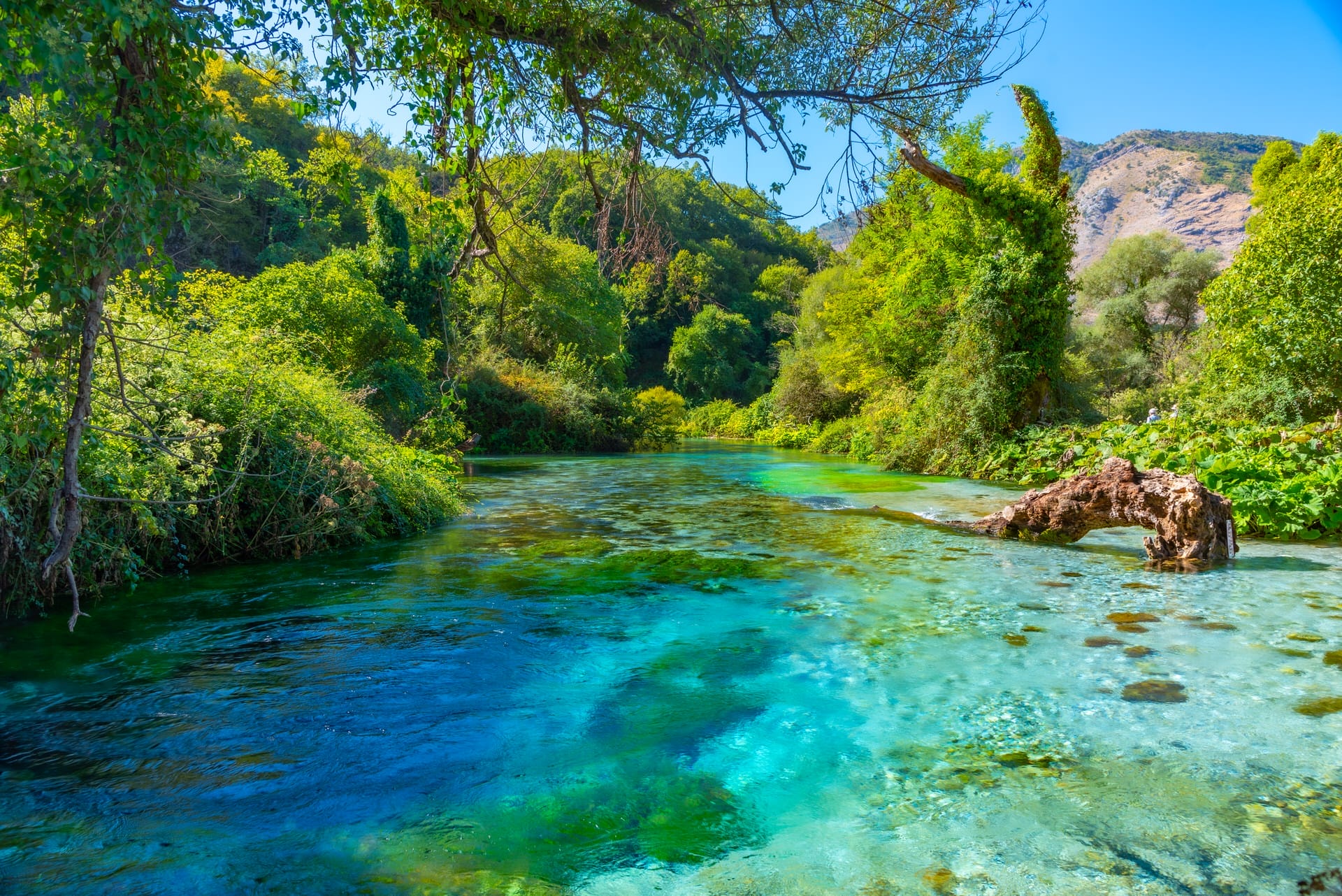
Blue Eye Spring (Syri i Kaltër): Karst spring near Sarandë producing blue water from depths exceeding 50 meters (full depth unknown). The spring creates 18+ meter diameter pool feeding the Bistrica River. Tourism popularity led to infrastructure improvements (parking, fencing, entrance fees 100 LEK/~€1) managing visitor access.
Bënja Thermal Springs: Natural hot springs (30-32°C) along Langarica River near Përmet, offering free-access warm water bathing in riverside pools. Ottoman-era Kadiut Bridge adjacent to springs creates photogenic setting.
Caves: Albania contains numerous caves, many unexplored or minimally documented. Accessible caves include Pellumbas Cave (Dajti area, prehistoric archaeology), Pirogoshi Cave (near Berat), and various caves in Karaburun Peninsula accessed by boat tours. Serious caving requires specialized guides and equipment—most caves lack tourist infrastructure.
Karst hydrology means underground rivers and springs appear throughout Albania, creating water sources and unique ecosystems, though these require technical access beyond casual tourism.
Protected Areas and Conservation Status
Albania has established protected areas covering approximately 15% of national territory (around 400,000 hectares) across 15 national parks, nature reserves, and protected landscapes. Major parks include:
- Valbona Valley National Park (8,000 hectares)
- Theth National Park (26,630 hectares)
- Llogara National Park (10,100 hectares)
- Divjakë-Karavasta National Park (22,230 hectares, including Karavasta Lagoon)
- Vjosa Wild River National Park (300km river corridor, established 2023)
- Karaburun-Sazan Marine National Park (12,570 hectares)
Park management faces challenges including limited budgets, inadequate staffing, insufficient enforcement against hunting/fishing violations, and infrastructure pressures from tourism growth. International conservation organizations support protection efforts, though effectiveness varies by site and management capacity.
Endemic and endangered species include the Balkan lynx (critically endangered, possibly fewer than 50 individuals in Albania), brown bear (estimated 200-300), gray wolf (estimated 250), Egyptian vulture, Dalmatian pelican, and various endemic lake species. Protection requires balancing conservation goals with economic development pressures and local community needs.
Seasonal Considerations for Natural Tourism
Albania’s natural attractions vary significantly by season:
Spring (April-June): Rivers run high from snowmelt (good for rafting, challenging for canyon hiking), wildflowers bloom, temperatures moderate (15-25°C), birds migrate through wetlands. Mountain trails may have lingering snow at higher elevations.
Summer (July-September): Peak season for mountains and coast, warmest weather (25-35°C), lowest river levels, crowded beaches and popular parks. Alpine hiking conditions optimal, though heat can be intense at lower elevations.
Autumn (September-October): Shoulder season with comfortable temperatures, autumn colors in mountains, reduced crowds, but services beginning to close in seasonal areas. Good for hiking and coast visiting before November weather deteriorates.
Winter (November-March): Most mountain areas inaccessible or requiring winter mountaineering skills, coastal areas quieter, reduced services. Some lower-elevation parks (Dajti, Llogara in good weather) accessible, but northern mountains are closed due to snow.
Planning visits requires considering seasonal access and conditions—summer offers maximum accessibility but peak crowds, shoulder seasons balance weather and visitor numbers, winter limits options significantly.
Albania’s Natural Wonders in Regional Context
Albania’s natural attractions compete with and complement neighboring Balkan destinations:
- Montenegro offers similar coastal and mountain scenery with more developed tourism infrastructure
- North Macedonia shares Lake Ohrid with Albania but has the UNESCO historic core
- Greece provides more extensive beaches and islands with mature tourism services
- Kosovo and Serbia offer mountain landscapes with different cultural contexts
Albania’s advantages include less commercialization (for now), lower prices, recent conservation initiatives (Vjosa River National Park), and the combination of Mediterranean coast with alpine mountains in compact area. Disadvantages include developing infrastructure, limited services in remote areas, and less international recognition than competing destinations.
For visitors seeking European mountain and coastal scenery without Croatia/Greece crowds and prices, Albania provides legitimate alternative accepting trade-offs of basic facilities and emerging tourism sector.