How to Get to Vlorë
From Tirana
- By Bus: Frequent buses (every 30-60 minutes) from southern terminal. Journey takes 2.5-3 hours and costs 600-800 LEK (€5-7).
- By Car: 147km via A2/SH4 highway through mountains. Drive time approximately 2-2.5 hours on well-maintained roads.
- By Tour: Day trips available starting at €40-50 per person.
From Saranda or Albanian Riviera
- By Bus: Regular buses along coastal SH8. From Sarandë: 2.5-3 hours, 800-1,000 LEK. From Himarë: 1.5 hours, 500-600 LEK.
- By Car: 130km from Sarandë via spectacular coastal road. Plan 2.5-3 hours including Llogara Pass.
From Italy
- By Ferry: Seasonal ferries from Brindisi, Italy (8-10 hours overnight). Check schedules with Adria Ferries or European Seaways.
Why Visit Vlorë
November 28, 1912, at 5:30 PM precisely, in a pale yellow building overlooking Vlorë Bay, Ismail Qemali raised the red and black Albanian flag from the second-floor balcony and declared independence after nearly 500 years of Ottoman rule that had begun with Skanderbeg’s death in 1468. Eighty-three delegates representing Albanian territories from Kosovo to Chameria voted unanimously to create an independent Albanian state, a ceremony that lasted exactly 90 minutes before messengers rode out to spread the news to surrounding regions. The timing was desperate rather than carefully planned—the Balkan Wars raging throughout 1912-1913 had shattered Ottoman control across the peninsula, creating a power vacuum, but Greece, Serbia, and Montenegro were advancing rapidly and grabbing traditionally Albanian-inhabited territories as fast as they could mobilize troops and administrators. The window for declaring independence was closing with each passing day as facts on the ground became harder to reverse. Act immediately and gamble on international recognition, or wait and watch Albania be partitioned among neighbors who had explicit territorial ambitions. The delegates in Vlorë, understanding they might have mere weeks before the opportunity vanished entirely, voted to create a nation and hope the Great Powers would recognize it before the neighbors carved it up completely.
It didn’t prevent territorial disputes. The 1913 Treaty of London recognized Albanian independence but handed roughly half of Albanian-inhabited lands to neighbors - borders that remain contentious today. Vlorë itself got occupied immediately: Greek forces in October 1914, Italian protectorate 1914-1920, changing hands multiple times through WWI.
But Albania existed. That pale yellow building - merchant Dhostan Kaloshi’s house - is now the Museum of Independence (established 1936, Albania’s oldest museum). The voting chamber looks exactly like it did in 1912. Simple wooden furniture. Albanian flags. Photographs from the November evening when 83 men gambled on independence.
November 28 is Albania’s most important national holiday. For Vlorë (population 141,000), that 1912 declaration defines everything beyond its roles as Albania’s second-largest port and Albanian Riviera gateway.
Where Two Seas Collide
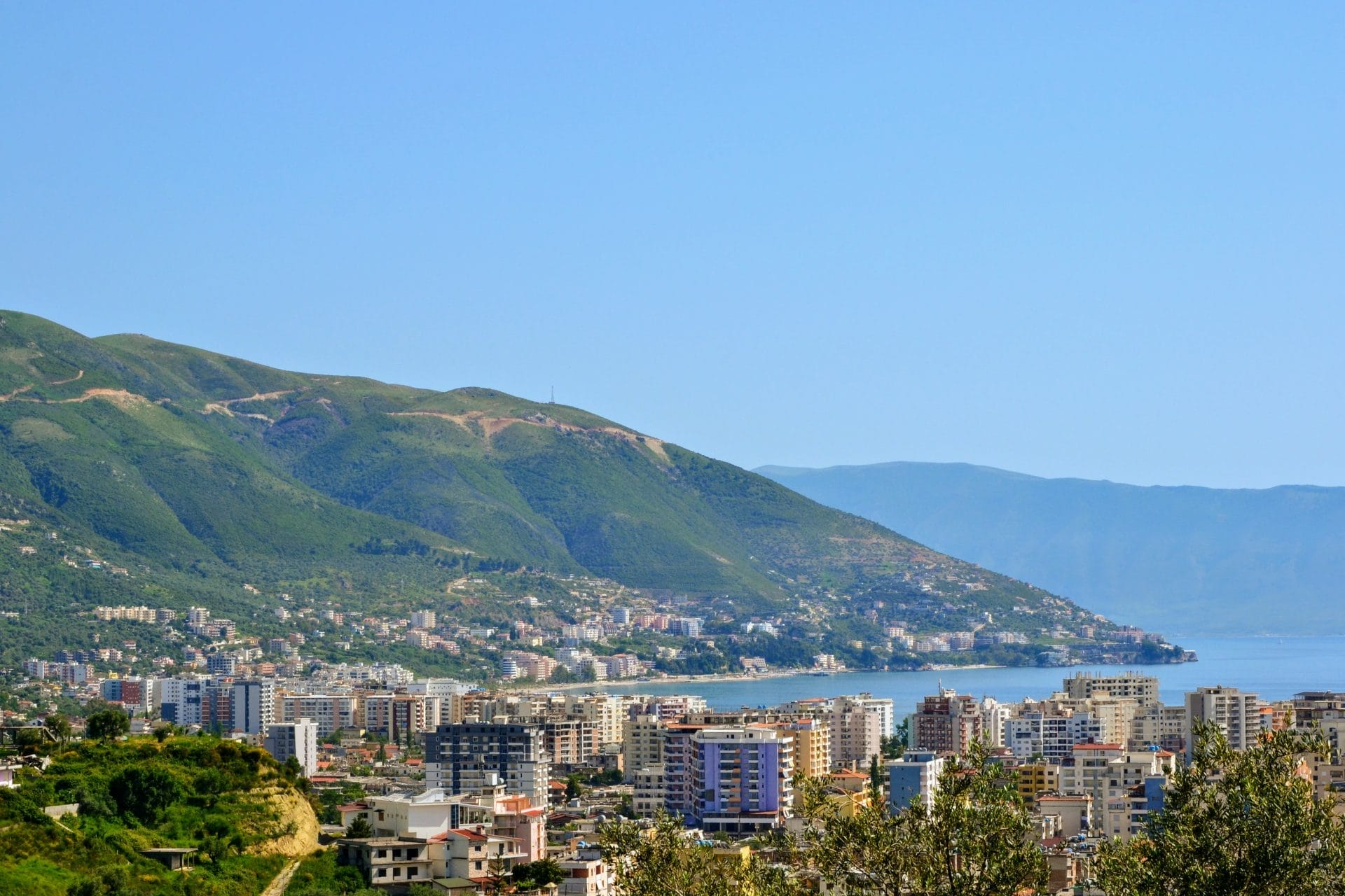
Vlorë sits at the exact point where the Adriatic Sea meets the Ionian Sea. The boundary lies at Karaburun Peninsula tip, 20km west - the Strait of Otranto (71km to Italy’s Salento Peninsula) separates the two basins.
This creates weird maritime conditions. Adriatic’s shallower, warmer waters mixing with Ionian’s deeper, cooler currents. Complex underwater topography. Fish species from both sea systems. Exceptional fishing grounds that have sustained communities for millennia. Unpredictable weather - storms develop rapidly when weather systems from different directions collide over the strait.
The Ceraunian Mountains (“Thunder Mountains” - Albanian: Malet e Vërteta) rise immediately behind Vlorë. Mount Çika hits 2,045 meters just 20km from the coast. That dramatic elevation change creates rain shadows, or ographic precipitation, microclimates where Mediterranean vegetation grows at sea level while alpine conditions exist on peaks you can see from the city.
The strategic value is obvious. Control Vlorë = control the narrowest Italy crossing point (Strait of Otranto), access to deep-water Vlorë Bay natural harbor, mountain passes connecting coast to interior Albanian territories. Illyrians, Greeks, Romans, Byzantines, Normans, Venetians, Ottomans, Italians, Soviets - everyone wanted this position.
Practical effect for visitors: Northern shore beaches (Adriatic side) have shallower gradual depths, good for families. Southern beaches (Ionian side) have steeper drop-offs, clearer water, better for snorkeling/diving.
3,600 Soviet Bunkers on One Island
Sazan Island (5.7 sq km, Albania’s largest) sits 10km west at Vlorë Bay entrance. Italy built a naval base 1914-1920. Albania maintained military presence 1920-1944. Nazi Germany fortified it during WWII occupation. Then the Soviets (1957-1961) transformed it into one of the Mediterranean’s most fortified islands.
Soviet engineers carved massive submarine pens into limestone cliffs. Underground facilities where submarines docked, refueled, rearmed, got maintenance - all protected from aerial reconnaissance. Bar racks for 3,000 military personnel. Ammunition tunnels. Command centers. And approximately 3,600 concrete bunkers - small pillboxes to large artillery emplacements.
When Albania broke with the USSR in 1961 (sid ing with China during Sino-Soviet split), Soviets left everything intact. Albanian forces occupied it, maintaining Sazan as primary naval fortress through the 1960s-1980s despite isolation from both Western and Eastern blocs. Hoxha’s paranoia (manifested in 750,000 bunkers built across Albania 1967-1986) treated Sazan as critical for defending against invasions from Yugoslavia, Italy, Greece, or a Soviet-led Warsaw Pact.
Invasions that never came.
1991: communism collapsed. Sazan became financially unsustainable. The base operated at reduced capacity through 1990s-2000s, slowly deteriorating. 2017: Albanian government opened portions to tourism while maintaining restricted military zones.
Tours (June-Sept, €25-35, ~4 hours) show submarine pens - massive concrete caverns. Bunker fields creating surreal landscapes. Abandoned barracks. Beaches where turquoise Mediterranean water laps crumbling concrete fortifications. Cold War paranoia meeting Mediterranean beauty.
The island’s ecology recovered. Posidonia oceanica seagrass meadows (UNESCO protected) flourish. Monk seals surface in coves. Mediterranean maquis vegetation reclaims bunkers. Wild rabbits live in fortifications built to repel Soviet invasion.
3,000 Flamingos at Narta Lagoon
Narta Lagoon: 41 sq km, 12km north of Vlorë. Shallow (average depth 1.5m, max 3m), brackish water separated from Adriatic by narrow sand barrier. Protected wetland environment.
3,000-5,300 greater flamingos (Phoenicopterus roseus) - roughly 4% of Europe’s Mediterranean population. They feed on brine shrimp (Artemia salina) using specialized filter beaks. Winter (Nov-March) sees largest concentrations. Their pink color comes from carotenoid pigments in crustacean diet - the pinker the bird, the better the diet, the healthier the individual.
200+ bird species total: Dalmatian pelicans (vulnerable), pygmy cormorants, herons, ducks, waders. Critical stopover on the Adriatic flyway. Migrations peak spring (March-May) and autumn (Sept-Nov). Best birdwatching: 6-9 AM when light is optimal.
The controversy: Vlorë International Airport (scheduled 2025-2026) is being built 3km from Narta’s eastern shore. Environmental impact assessments identified significant risks: habitat loss, noise pollution, potential fuel contamination. Economic development priorities outweighed ecological concerns. The airport’s opening will inevitably alter Narta’s character - extent of damage remains to be seen.
Zvernec Monastery (13th-14th century Byzantine) sits on an island in the lagoon, accessed via 270m wooden footbridge. Small stone church, single nave, modest exterior. Closed during communism, reopened post-1991 as tourist attraction (no longer active religious community).
Where Albania Began
Vlorë’s significance rests on November 28, 1912. The creation of modern Albania as an independent nation-state. Every Albanian schoolchild learns about it. That historical moment defines the city’s identity beyond port/beach/urban center roles.
Stand in the Museum of Independence. You’re in the room where 83 delegates voted to create their nation. Simple furniture. Albanian flags. Photographs from the November evening when Ottoman Empire was collapsing, neighbors were grabbing territory, and the window for independence was brief. Act now or be partitioned.
They acted. Albania exists. Survived Italian occupation, WWII, communist dictatorship, 1990s chaos. Emerged as a functioning (imperfect) European state.
Beyond independence history: Adriatic-Ionian confluence. Mimar Sinan mosque (one of fewer than 12 outside Turkey). Sazan’s 3,600 Soviet bunkers. Narta’s flamingos. These aren’t consolation prizes - they’re genuine interesting features creating a destination for travelers interested in Albanian history, unusual geography, ecology, military history.
Not for travelers seeking UNESCO-perfect historic centers or boutique tourism culture. Vlorë is a working port/industrial city (population 141,000). Italian occupation and communism destroyed much of the historic center. The Ceraunian Mountains are visible but 20km away. This is authentic Albania - tourism exists alongside shipping, fishing, light industry.
Budget €40-70 daily. The Albanian Riviera starts 60km south at Llogara Pass. Apollonia is 25km north. The room where Albania became a nation is waiting.