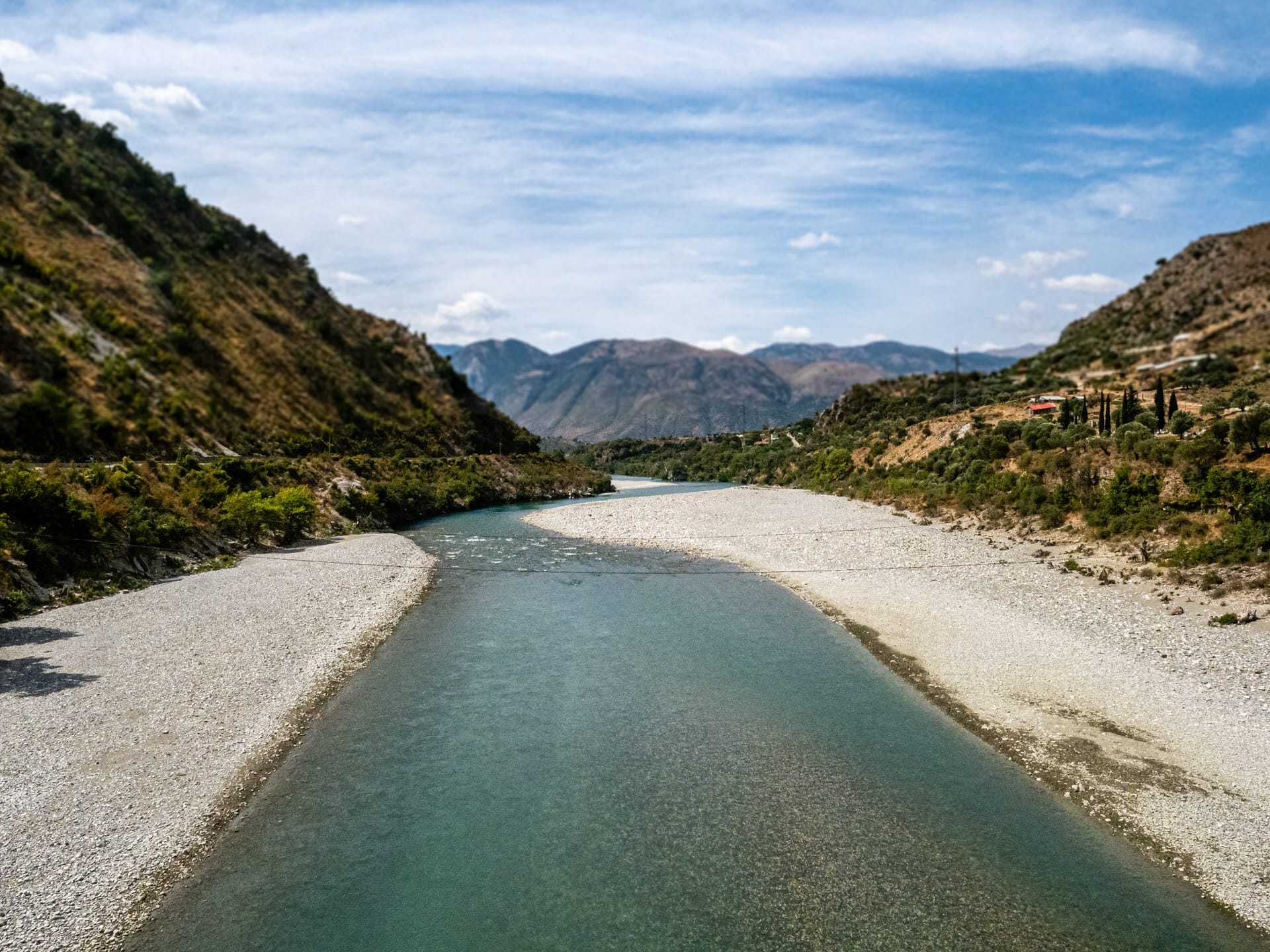
What Langarica Canyon Offers
Langarica Canyon is a narrow limestone gorge carved by the Langarica River approximately 13 kilometers from Përmet in southern Albania. The canyon offers hiking route (approximately 5 kilometers one-way) that follows the river through the gorge, requiring multiple water crossings where hikers wade through the stream (depths varying from ankle-deep to waist-deep depending on season and water level), eventually reaching Bënja thermal springs at the canyon’s upper end.
The canyon hike is an alternative to the standard approach to Bënja thermal springs—instead of driving to the parking area and walking the maintained 1.5-kilometer trail, hikers can start from a different access point and experience the canyon scenery while wading through the river. This appeals to visitors who want more adventurous route combining hiking and water crossings rather than simple walking trail.
The canyon walls rise vertically from the river in sections, creating narrow passages where limestone cliffs reach 100-200+ meters height. The river itself is clear mountain water, cold even in summer (typically 10-15°C), flowing over rocky bottom with pools, small rapids, and calm sections. The canyon contains vegetation (trees, bushes, some wildflowers in spring) growing where slopes allow, creating green contrast to gray limestone.
The Canyon Hiking Route and Water Crossings
The typical canyon hike begins from a trailhead accessible via rough road from Përmet direction (ask locals or tour operators for specific starting point as signage is limited). The route follows the river upstream through the gorge for approximately 5 kilometers, emerging at Bënja thermal springs area near Kadiut Bridge.
The water crossings are the defining feature and the challenge. The river must be crossed repeatedly (some sources say 10+ times, though exact number varies by route choices and water level) where the canyon narrows or trail switches between banks. During summer low water (July-September), crossings are typically ankle to knee-deep. During spring high water (April-May) or after heavy rain, crossings can reach waist-deep or become dangerous/impassable.
Water shoes or sturdy sandals with good grip are essential—the riverbed is rocky and slippery, bare feet risk injury, and regular hiking boots get soaked (they don’t dry during the hike). Many hikers wear quick-dry clothing or swimwear under shorts/pants accepting that getting wet is inevitable. Waterproof bag or dry bag for phone, wallet, and items that shouldn’t get wet is recommended.
The hike duration is typically 2-3 hours from canyon entrance to Bënja thermal springs, though this varies significantly based on water level (deeper water slows progress), hiker fitness, and how much time is spent navigating crossings or photographing scenery. The return can use the same canyon route (another 2-3 hours) or the standard trail/road back to Përmet if transport is arranged.
Kadiut Bridge and Historical Context
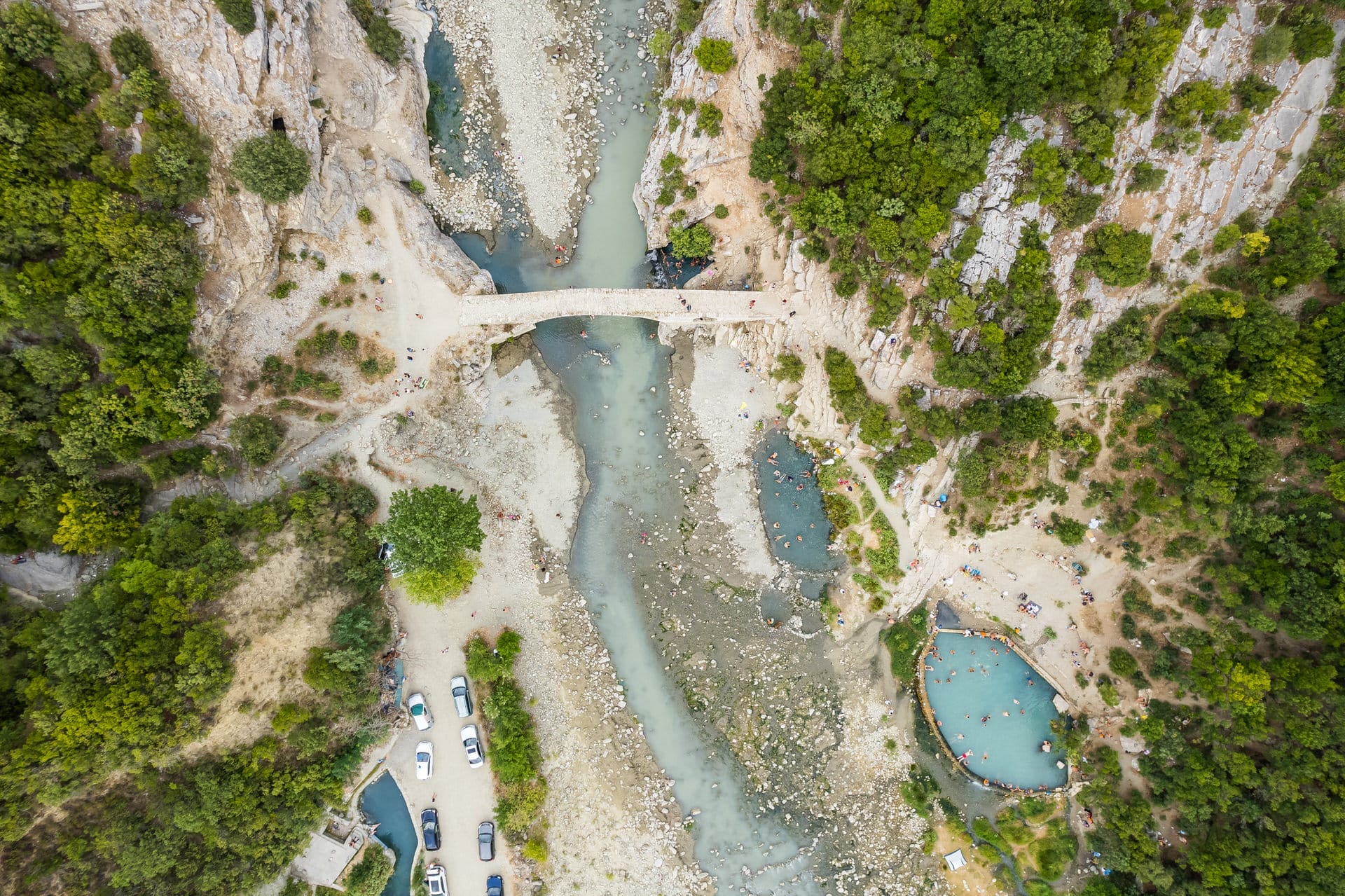
Kadiut Bridge (also spelled Kadiu or Qafez Bridge) is an 18th-century Ottoman-era stone arch bridge crossing the Langarica River near Bënja thermal springs. The bridge is single arch, approximately 10-15 meters span, built with traditional stone masonry techniques. The bridge appears on the canyon hike route—hikers either pass under it or cross it depending on exact trail variation.
The bridge originally served local transport and access to mountain villages, connecting Përmet region to higher elevation settlements. During Ottoman period (15th-19th centuries), such bridges were constructed throughout Albania to facilitate trade and administrative control. Kadiut Bridge is modest example—not as large or ornate as major Ottoman bridges like Gorica Bridge in Berat, but well-preserved and photogenic with river and canyon as backdrop.
The area around the bridge includes Bënja thermal springs (the main destination for most canyon hikers), small restaurants/cafes serving visitors, and the parking area where the standard trail to thermal springs begins. The bridge thus marks the transition from remote canyon to developed (albeit basic) tourism area.
Langarica River Beyond the Canyon
The Langarica River extends beyond the canyon section—upstream it flows from mountains east of Përmet (Trebeshinë and Nemercka ranges), fed by numerous tributaries and springs. The upper sections see minimal tourism, accessed mainly by shepherds and hunters. Downstream from Bënja, the river continues through gentler valley terrain before joining the Vjosa River system.
The canyon section (the 5-kilometer gorge hike) represents the most dramatic and accessible part of the Langarica. Other sections lack the vertical walls and narrow passages that make the canyon notable. The river’s name comes from local geography—“Langarica” likely derives from Albanian terms for narrow passage or ravine, appropriate given the canyon’s character.
Safety Considerations and Guided Tours
The canyon hike has inherent risks that require consideration:
Water level hazards: High water makes crossings dangerous or impossible. Spring snowmelt and heavy rain can raise water levels quickly. There’s no reliable real-time water level information—hikers must assess conditions upon arrival and turn back if conditions seem unsafe.
Flash flood potential: Mountain storms can cause rapid water level rise. Check weather forecasts, avoid hiking if rain is predicted upstream, and be prepared to evacuate canyon quickly if water starts rising.
Slippery surfaces: Wet rocks are extremely slippery. Falls can result in injuries, particularly concerning in remote canyon where rescue is difficult.
Navigation: The route is not always obvious—trail markers are sparse or non-existent in sections. Experienced hikers comfortable with route-finding manage, but first-timers or less experienced hikers benefit from guides.
Limited rescue access: The canyon is remote. Mobile phone reception is unreliable. If someone is injured, getting help and evacuating them is complicated and time-consuming.
Guided tours from Përmet-based operators (€20-40 per person typically) provide knowledge of current conditions, navigation, and safety support. Solo hikers should have good fitness, mountain experience, and conservative judgment about turning back if conditions are challenging.
The Honest Assessment
Langarica Canyon hike offers genuine adventure hiking combining gorge scenery, water crossings, and arrival at thermal springs via challenging route rather than easy trail. For hikers who enjoy stream wading, route-finding, and accepting some risk in exchange for less-crowded experience, the canyon provides worthwhile alternative to standard Bënja thermal springs access.
What the canyon isn’t is family-friendly easy hike or suitable for all fitness levels. The water crossings, potential for changing conditions, navigation requirements, and remote setting make this appropriate for experienced hikers comfortable with backcountry travel rather than casual visitors wanting scenic walk.
Compared to other Albanian canyon hikes (Osumi Canyon near Berat is longer and more developed, Kelcyre Canyon has similar character but different access), Langarica is moderate difficulty—not extreme technical canyoning but not gentle nature stroll either.
Skip If: You’re uncomfortable with water crossings or can’t swim (falling in deep section could be problematic), if you have limited hiking experience or questionable fitness, if you’re traveling with young children or elderly/less mobile visitors, if you visit during spring high water (April-May) when crossings are deep and potentially dangerous, if weather is unstable or rain is forecast, if you prefer maintained trails with clear signage, or if you can reach Bënja thermal springs via standard 1.5km trail and don’t need canyon adventure.
Visit If: You’re experienced hiker comfortable with stream crossings and route-finding, if you visit during summer low water (July-September) when conditions are safest, if you want more adventurous approach to Bënja thermal springs rather than standard trail, if you’re hiring local guide who knows current conditions and route, if you have proper footwear (water shoes, sturdy sandals) and waterproof protection for gear, or if you specifically enjoy canyon hiking and accept the risks involved.
The canyon works as enhancement to Përmet region visit for adventure-oriented travelers rather than as mainstream attraction. Combine with Bënja thermal springs (you end up there anyway), Përmet’s wine tasting, Vjosa River activities, and the region’s food scene. Consider the canyon as optional challenging route versus the standard easy trail—both reach the same thermal springs, choose based on your hiking ability and desire for adventure.
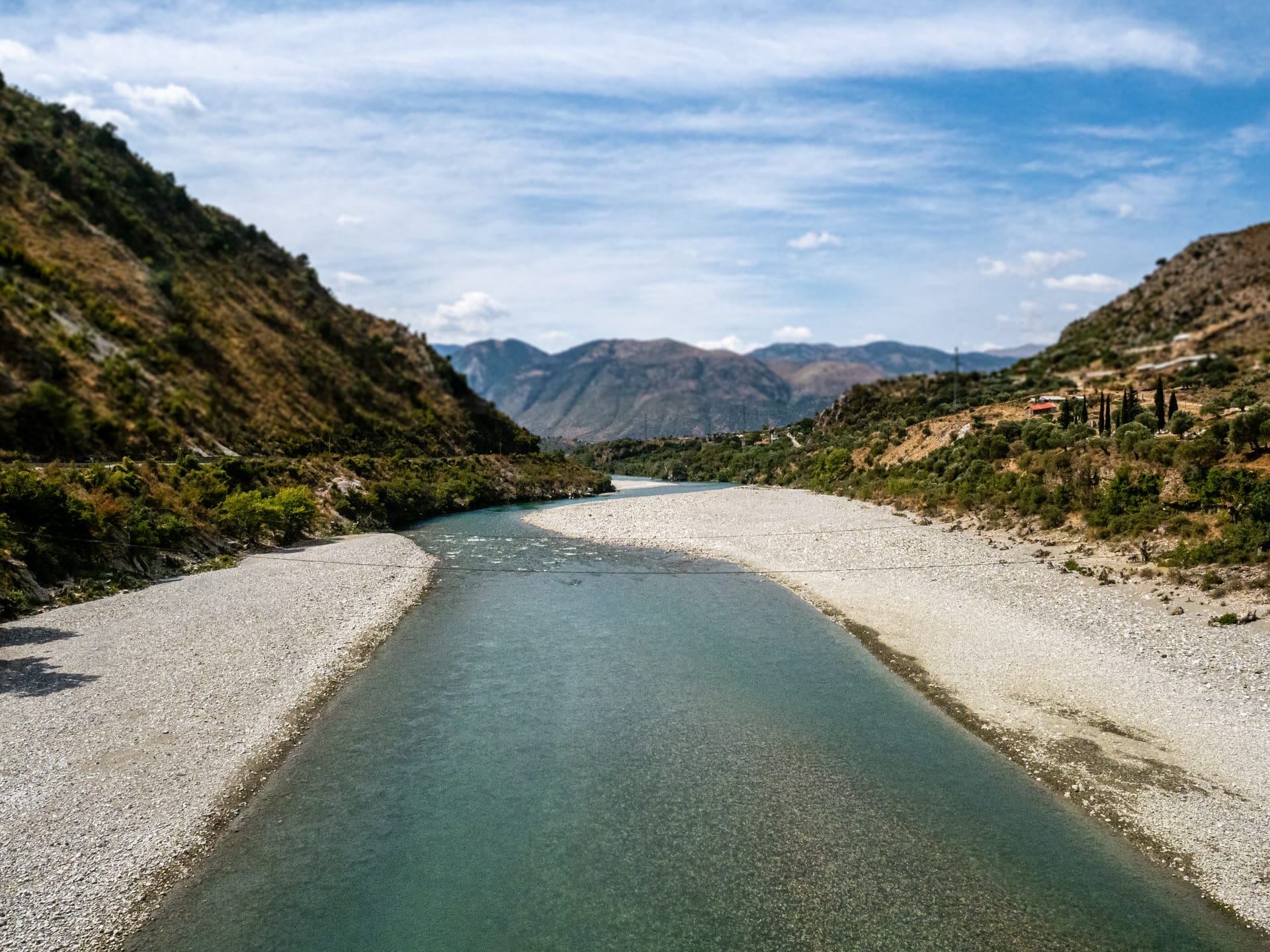
Langarica River flowing through the narrow canyon near Përmet
Limestone canyon walls of Langarica with hikers navigating the river route
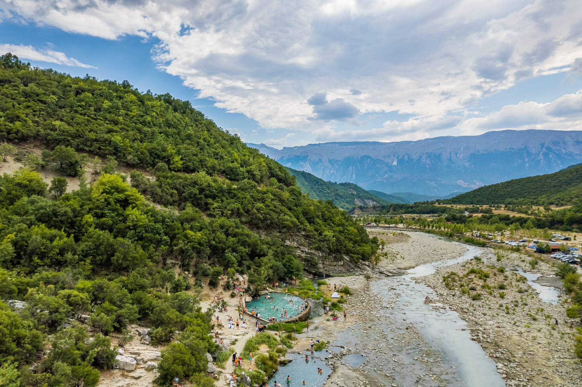
Thermal springs at Bënja, reached via either Langarica Canyon hike or standard trail
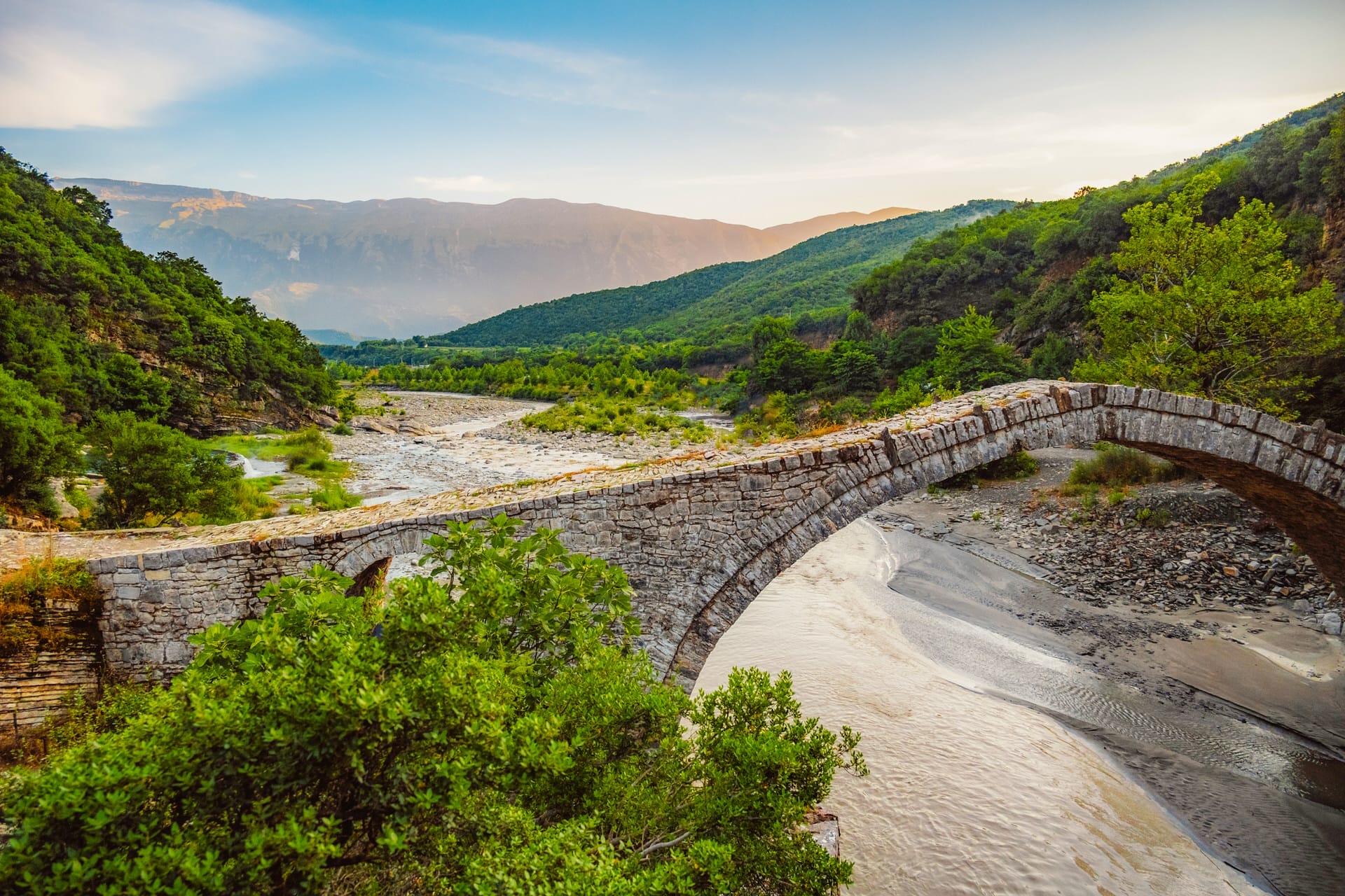
Kadiut Bridge (18th century Ottoman bridge) crossing Langarica River near Bënja thermal springs