What Dajti National Park Offers
Dajti National Park occupies 29,384 hectares of mountain terrain east of Tirana, centered on Mount Dajti (1,613 meters elevation). Established 1966 during Albania’s communist period, the park was among Albania’s first protected areas, originally created to preserve forests and watershed serving Tirana while providing recreation area for the capital’s residents. This dual purpose continues—the park protects biodiversity and water sources while serving as Tirana’s accessible mountain escape.
The park spans elevations from approximately 600 meters (lower valleys) to 1,613 meters (Mount Dajti summit), creating vegetation zones from Mediterranean maquis through oak and beech forests to subalpine meadows near the peak. The park’s accessibility (25 kilometers from Tirana city center, cable car access to summit area) makes it Albania’s most visited national park, though infrastructure beyond the cable car station remains basic.
The main attraction is the Dajti Ekspres cable car, built 2005, transporting visitors from the park entrance (near Porcelan village) to the summit area in 15 minutes, eliminating the 2-3 hour hike. This convenience creates tourism focused on the cable car and summit facilities (restaurant, viewpoints) rather than extensive park exploration, though hiking trails exist for visitors wanting to walk beyond the immediate cable car area.
The Dajti Ekspres Cable Car Experience
The Dajti Ekspres cable car was constructed 2005 by Austrian company Doppelmayr, representing significant investment in Tirana-area tourism infrastructure. The cable car stretches 4.7 kilometers from the base station (at approximately 135 meters elevation near Porcelan village) to the upper station near Mount Dajti’s summit area (at approximately 1,050 meters), gaining 915 meters elevation. The ride takes approximately 15 minutes at operating speed.
The cabins hold 8 passengers each, with capacity for approximately 500 passengers per hour. During peak times (weekends, holidays, summer season) lines can form, requiring 30-60 minutes wait for boarding. Off-peak times (weekday mornings, winter) see minimal waits. The cable car operates year-round except during high winds or technical maintenance.
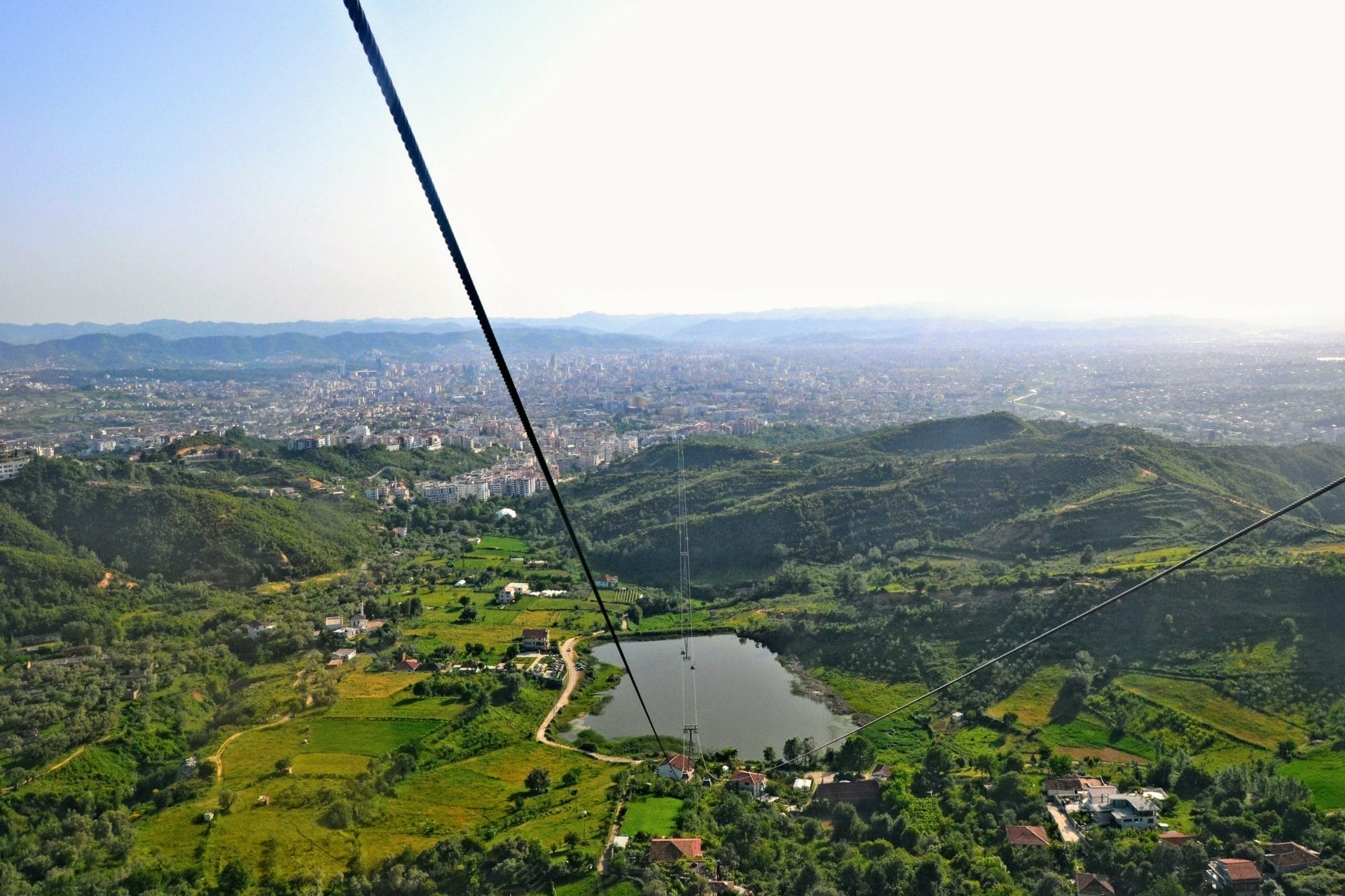
Tickets cost 1,200 LEK (€10) for round trip, 700 LEK (€6) one-way (purchased at base station ticket office or online via booking platforms). The cable car provides views during ascent—initial section crosses forest, middle section offers views toward Tirana and the coastal plain, upper section approaches the summit area with views expanding to include mountains beyond the park.
At the upper station, facilities include:
- Rotating Restaurant (Ballkoni i Dajtit): Revolving restaurant providing 360-degree views while rotating slowly (one full rotation ~1 hour). The food is tourist-oriented with elevated prices (€15-25 per person for meal), serving Albanian and international dishes. The view is the attraction more than the cuisine.
- Viewpoints: Several observation platforms around the upper station area offering views toward Tirana (west), coastal areas, and surrounding mountains.
- Short walking trails: Paved paths near the upper station allow walking 10-15 minutes to alternative viewpoints.
Hiking Trails in Dajti National Park
The park contains numerous hiking trails, though most are unmarked and require navigation skills or local guides. The marked/well-known trails include:
Qafa e Dajtit Trail (Summit Trail): The main hiking route from park entrance to Mount Dajti summit, approximately 8-10 kilometers one-way, gaining 1,000+ meters elevation. The trail begins near the cable car base station and climbs through forest, emerging at treeline before reaching the summit area near the cable car upper station. The hike takes 2.5-3.5 hours ascending, 2-2.5 hours descending. The trail is clearly visible but not maintained—expect rough sections, erosion, and some scrambling over rocks. Many hikers take the cable car up and hike down (or reverse) to avoid the full elevation gain in one direction.
Mali me Gropa Trail: A ridge trail extending northeast from Mount Dajti summit area toward Mali me Gropa peak (approximately 1,800 meters), continuing the elevation gain beyond Dajti proper. This is longer day hike (6-8 hours round trip from cable car upper station) requiring mountain hiking experience and good weather. The trail offers views across the park and toward Lake Bovilla (a reservoir visible north of the park).
Forest Loop Trails: Various shorter trails (2-5 kilometers) through oak and beech forests at mid-elevations, accessible from roads entering the park from Tirana side. These are unmarked and require asking locals or hiring guides for specific routes. The trails offer forest walking without the elevation gain of summit hikes.
Pellumbas Cave Access: A trail leads from Pellumbas village (south of the park) to Pellumbas Cave (Shpella e Pellumbasit), a cave containing prehistoric archaeological evidence. The trail is approximately 1 hour hike from village, suitable for families, leading to cave entrance (flashlight required for cave exploration).
Wildlife sightings are possible but not common—deer are most frequently seen (early morning/evening), wild boar leave signs (rooted earth) but avoid humans, foxes appear occasionally. Bird species include golden eagles (rare sightings), various raptors, and forest birds. The park’s proximity to Tirana and hunting pressure (despite prohibition) mean large mammals are wary and rarely visible.
Flora and Biodiversity
The park hosts approximately 1,500 plant species, including oak (Quercus species dominating lower elevations), beech (Fagus sylvatica at mid-elevations), and pine varieties. Some endemic plant species exist—varieties found only in Albanian mountains or limited Balkan ranges—though the park isn’t as botanically significant as more remote Albanian protected areas with less human impact.
The forest composition reflects Mediterranean climate transitioning to continental influence as elevation increases. Lower slopes show maquis vegetation (shrubs including juniper, wild olive, aromatic herbs), while mid-elevations support dense deciduous forest. Higher elevations approaching the summit transition to subalpine meadows with grasses and alpine wildflowers (spring-summer bloom).
The park serves important watershed function—streams flowing from Dajti’s slopes feed water supplies for Tirana and surrounding areas. Forest cover protects against erosion and regulates water flow, making conservation economically valuable beyond tourism or biodiversity considerations.
Seasonal Characteristics
Spring (April-June): Wildflowers bloom at all elevations, forests green up, temperatures moderate (10-20°C), occasional rain. Good hiking weather once snow melts from trails (April-May may have lingering patches above 1,200m). Cable car operates normally.
Summer (July-September): Warmest temperatures (20-30°C at summit, higher in Tirana below), dry conditions, clear views (when pollution allows), peak visitor season especially weekends. The summit area provides cooler escape from Tirana heat—temperature drop of 10-15°C compared to city. Cable car busy.
Autumn (September-November): Fall colors (October particularly), comfortable temperatures (15-25°C), reduced crowds after September, increasing rain as November approaches. Good hiking weather October-early November.
Winter (December-March): Cold at summit (often below 0°C, occasional snow), Tirana below remains milder (5-10°C). Cable car operates weather permitting—high winds or icing can cause closures. The summit area sees snow accumulation creating winter landscape, though the lower park areas may be snow-free. Winter hiking requires appropriate gear and conditions assessment.
Practical Access and Visit Planning
Getting to Dajti National Park from Tirana:
By car: 25 kilometers from Tirana center to cable car base station (near Porcelan village), approximately 40-50 minutes drive via SH3 highway then local roads. Parking available at base station (free or small fee depending on management).
By public transport: Bus line operates from Tirana to cable car area (irregular schedule, check current routes). Taxis from Tirana cost 1,500-2,000 LEK (~€12-16) one-way.
By tour: Organized day trips from Tirana include cable car tickets, transport, and guide (€25-40 per person typical).
Time Requirements:
- Cable car only visit: 2-3 hours total (transport + ride + 1 hour at summit)
- Cable car plus short hiking: Half day
- Summit trail hike (one direction, cable car other): Half day
- Full day hiking: 6-8 hours for extended trails
Costs:
- Park entrance: Free (national park has no entrance fee)
- Cable car: 1,200 LEK (~€10) round trip
- Restaurant at summit: €15-25 per person
- Guides (if hiring for remote trails): €20-40 per day
The Honest Assessment
Dajti National Park delivers convenient mountain access from Tirana via cable car, providing summit views and forest hiking without requiring multi-day mountain trips to Albanian Alps. For visitors with limited time in Tirana wanting mountain scenery, the cable car offers efficient half-day excursion. The park’s forests and biodiversity are genuine, the summit views on clear days extend to the Adriatic coast, and the hiking trails provide options beyond just the cable car ride.
What Dajti isn’t is wilderness park or exceptional mountain scenery compared to Albania’s premier destinations (Albanian Alps, Llogara). It’s Tirana’s local mountain—accessible, developed (relative to remote parks), and serving primarily recreational function for capital residents rather than destination attracting international visitors specifically. The cable car is modern convenience, the restaurant is tourist facility with tourist prices, and the park infrastructure reflects urban proximity.
Air quality can affect views—Tirana’s pollution sometimes reduces visibility from the summit, particularly summer when atmospheric conditions trap smog. Clear days (after rain, winter, spring mornings) provide better viewing than hazy summer afternoons. The park also shows impacts of proximity to major city—trails near access points have litter, illegal construction attempts occur on park edges, and hunting violations happen despite protection.
Skip If: You’re visiting Albania primarily for remote mountain experiences (Albanian Alps offer superior hiking), if you expect pristine wilderness (this is urban-adjacent park), if you’re uncomfortable with cable car tourism (preferring hiking-only access), if you have very limited Albania time and prioritize unique destinations (Dajti is convenient but not exceptional), or if weather is poor (clouds/fog eliminate views making cable car ride less worthwhile).
Visit If: You’re based in Tirana with half-day available and want mountain views, if you have mobility limitations making Albanian Alps difficult but want mountain access (cable car eliminates hiking requirement), if you’re interested in seeing Tirana’s recreational areas and how locals use mountain parks, if weather is clear and you want panoramic views including Adriatic coast, or if you’re combining cable car convenience with hiking (using cable car one direction, walking other).
Dajti National Park serves specialized purpose—Tirana’s accessible mountain providing quick escape from urban environment and introducing visitors to Albanian mountain landscapes without requiring remote travel. Consider it as Tirana day trip or introduction to Albanian mountains rather than as substitute for the country’s major mountain parks.
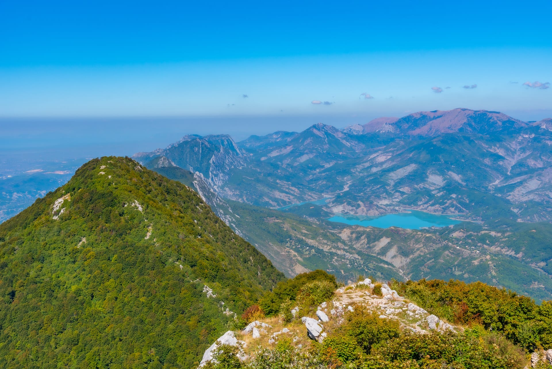
View from Dajti National Park toward Mount Tujanit and Bovilla Lake reservoir north of the park
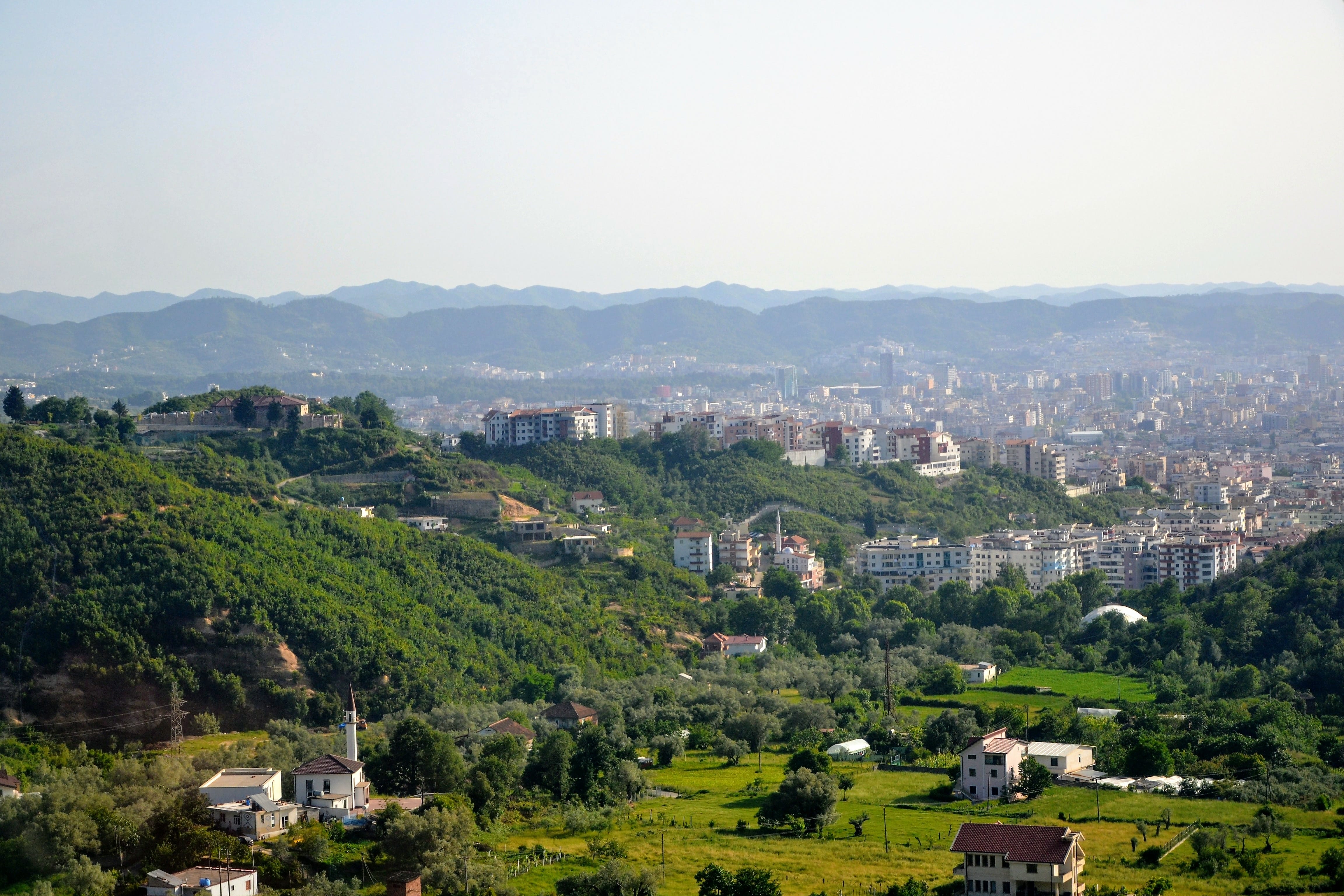
Tirana city viewed from Dajti Ekspres cable car during ascent
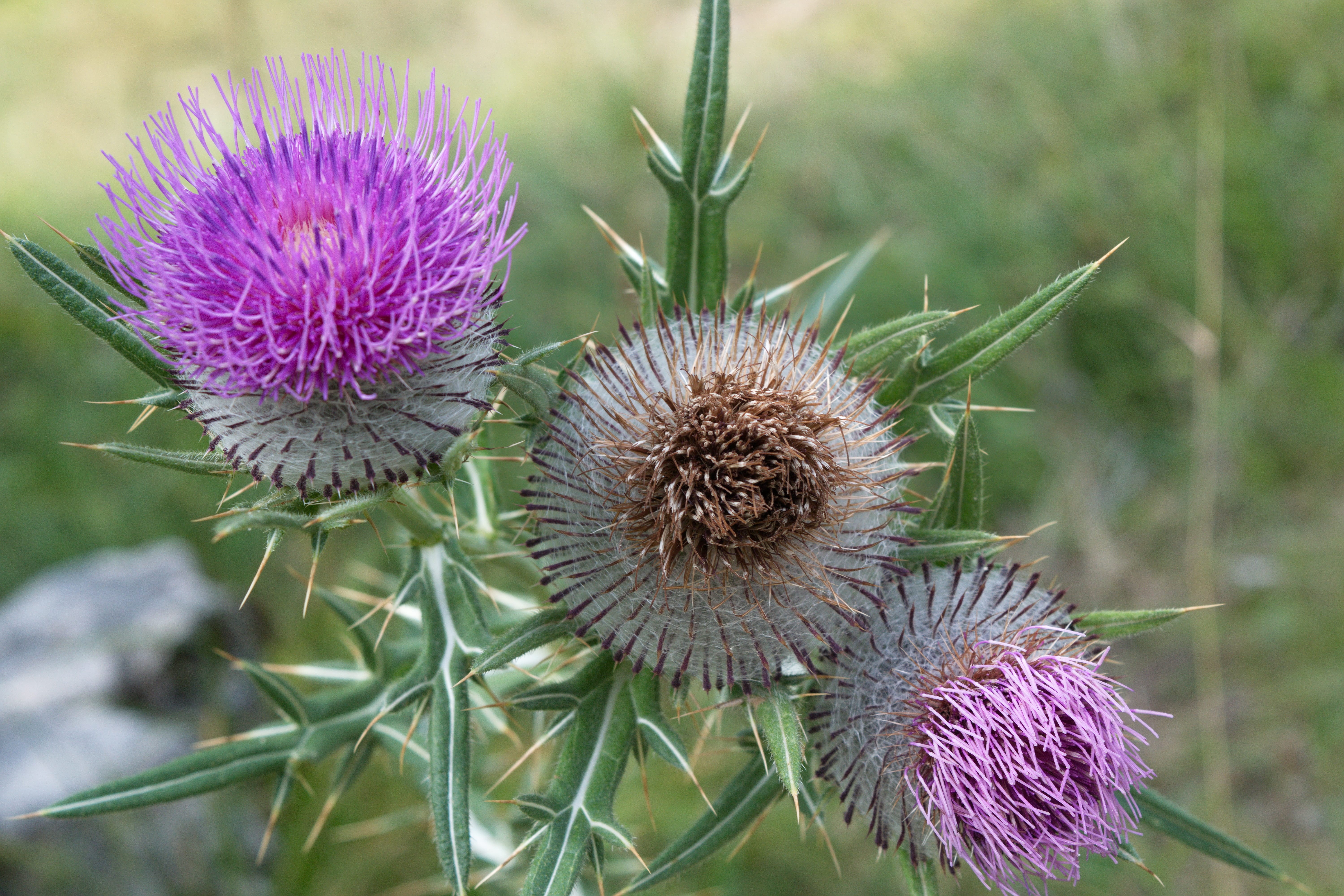
Wildflowers in Dajti National Park (spring-summer season)
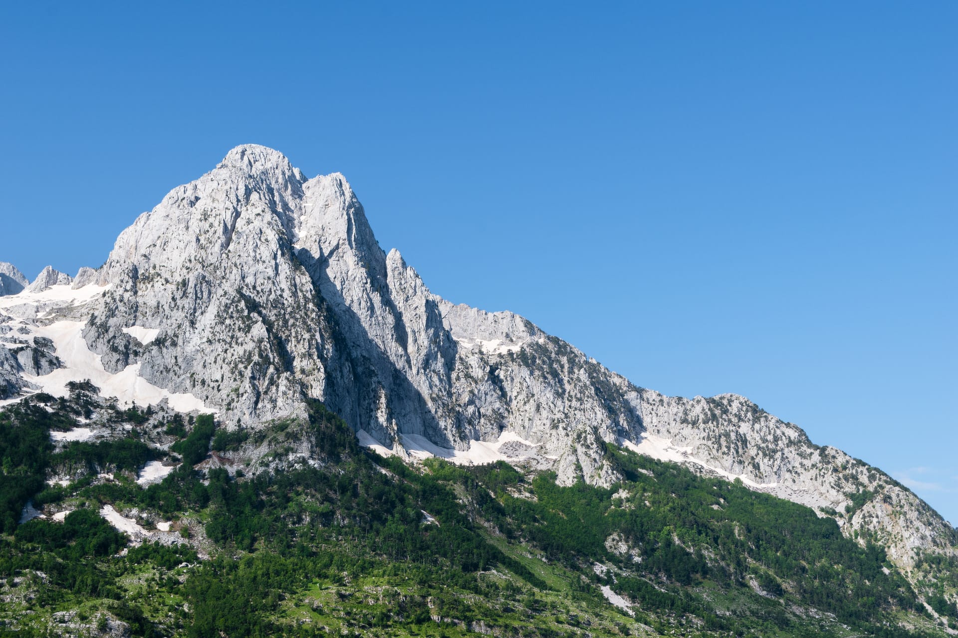
Mount Dajti terrain showing forested slopes characteristic of the national park