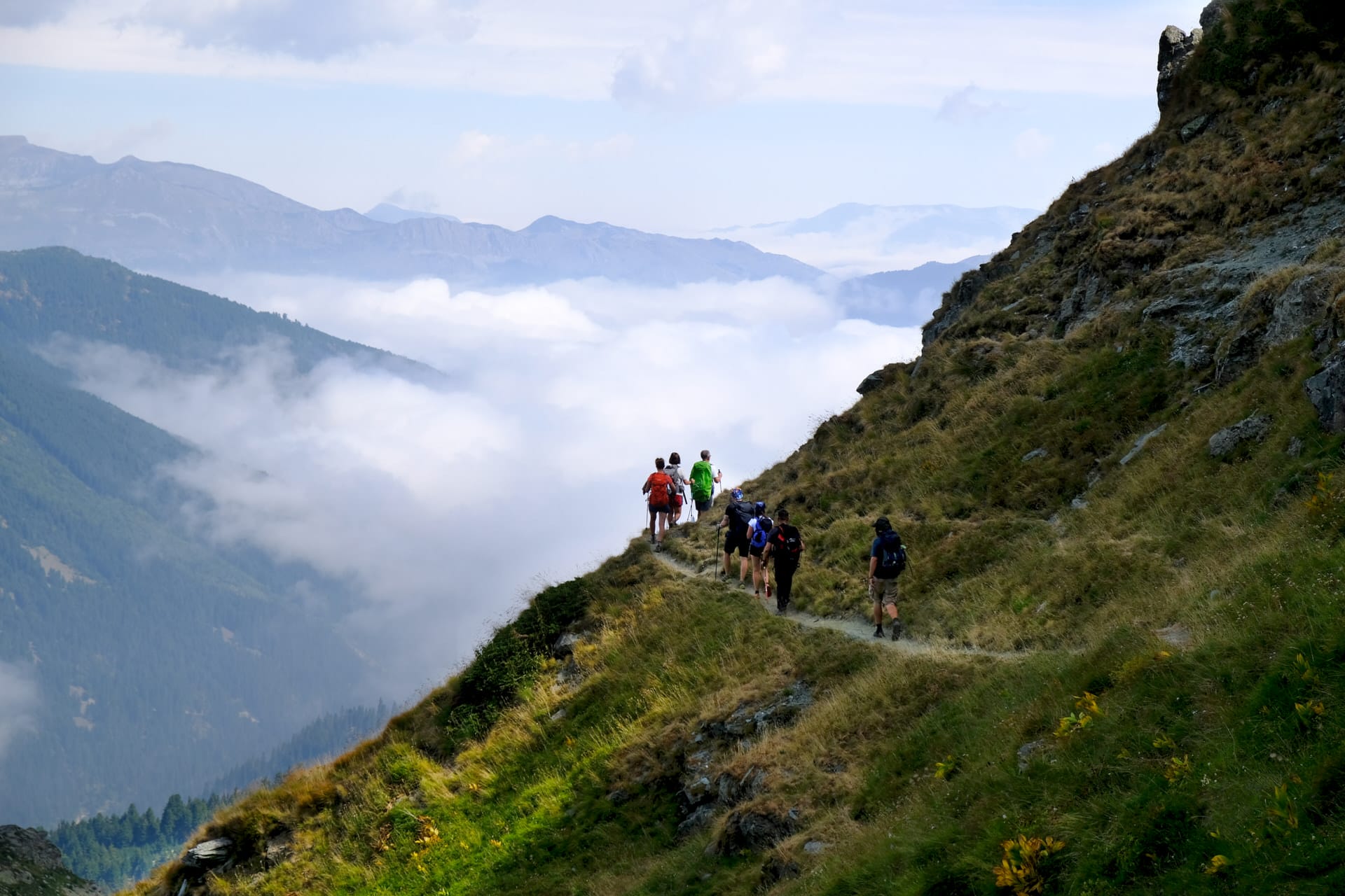
Why They’re Called Accursed
Two competing explanations exist for the name Bjeshkët e Nemuna (Albanian) or Prokletije (Serbo-Croatian)—both translating as “The Accursed Mountains.” The Slavic curse theory holds that medieval Serbian soldiers, frustrated by failed attempts to cross the range during campaigns against Albanian principalities, cursed the mountains for their impassability. The local explanation points to more practical concerns: avalanches, rockfalls, and sudden weather changes that killed shepherds, travelers, and entire families with sufficient frequency that residents considered the mountains actively hostile.
Both explanations contain truth. The Albanian Alps form the southern terminus of the Dinaric Alps, stretching approximately 60 kilometers from Lake Skadar northeast to Kosovo along Albania’s border with Montenegro. The range’s highest peak, Maja Jezercë, reaches 2,694 meters—making it not only Albania’s fifth-highest mountain but the highest summit in the entire Dinaric system extending from Slovenia to Albania.
The isolation these mountains created preserved social structures that disappeared elsewhere in Europe centuries ago. The Kanun—customary law codified in the 15th century—still governs dispute resolution in some mountain villages. Stone tower houses (kulle) built for blood feud defense remain inhabited. Sworn virgins (burrnesha)—women who took male social roles to preserve family lines after male deaths—lived in these mountains into the 21st century, with the last known sworn virgin dying in 2021.
The Two Valleys Everyone Visits
Valbona Valley sits on the range’s eastern flank, carved by the Valbona River descending from the Kollata massif (2,554m). The valley floor sits around 900 meters elevation, with valley walls rising almost vertically 1,700 meters to ridgelines—creating one of Europe’s most dramatic elevation gains directly above a valley floor.
Valbona village (population approximately 1,000) functions as base for the valley’s hiking infrastructure. Guesthouses charge €15-25 per person per night including dinner and breakfast. The valley road is paved from Bajram Curri (50 kilometers, 1.5 hours by furgon/minibus costing 300-400 LEK). From May through September, vehicles can drive the full length to the trail head; snow blocks the upper valley road October through April.
Theth Valley occupies the range’s western side, accessible from Shkodër via 70-kilometer mountain road (2.5-3 hours by furgon, 600-700 LEK). The road’s condition varies—spring floods and winter damage create sections requiring 4x4 vehicles, though furgons manage the route regardless. The valley sits at approximately 800 meters elevation, surrounded by limestone peaks exceeding 2,400 meters.
Theth village (population approximately 400, swelling to 1,000+ during summer with returned migrants and tourism workers) preserves the Albanian Alps’ most photographed architecture—stone kulle, the reconciliation tower (kulla e ngujimit), and the church sitting in meadows beneath vertical rock walls. Guesthouse prices match Valbona: €15-25 per night with meals.
The Trail Everyone Hikes
The Valbona-Theth crossing via Valbona Pass (Qafa e Valbonës, 1,795m) has become Albanian tourism’s most popular trek. The route covers 12-14 kilometers requiring 6-8 hours for most hikers, depending on conditions and fitness levels.
The Route Profile:
- Valbona starting elevation: ~900m
- Pass elevation: 1,795m
- Theth ending elevation: ~800m
- Elevation gain: 895m from Valbona, 995m descent to Theth
- Distance: 12-14 kilometers depending on exact route variations
The trail ascends through beech forest from Valbona village, emerging above treeline around 1,400 meters where the path becomes exposed rocky terrain. The pass itself is broad and grassy, marked by a small concrete monument. The descent to Theth is steeper than the Valbona ascent, dropping through scree fields before re-entering forest.
Logistics and Costs:
- Guides cost €40-60 for the crossing (not required—trail is well-marked)
- Horses/mules for pack transport: €25-40
- Early morning start (6-7 AM) recommended to avoid afternoon heat
- Water sources exist at intervals but bring 2-3 liters
- No facilities en route—bring food
- Mobile phone coverage absent for most of the trail
The trail operates June through September reliably. Snow blocks the pass October through May, though experienced winter trekkers with proper equipment cross in April and October during favorable conditions. Attempting the crossing May or late September means accepting potential snow on the pass.
Beyond the Standard Route
Maja Jezercë (2,694m): Climbing the Albanian Alps’ highest peak requires 2-3 days from either Valbona or Theth. The standard route from Valbona ascends via the Liqeni i Jezercës (Jezercë Lake) at approximately 1,900 meters, then continues to the summit via technical scrambling requiring basic mountaineering skills. Local guides charge €150-200 for the guided ascent. The climb is rated PD (peu difficile) in alpine climbing grades—meaning moderate technical difficulty requiring rope work for safety on some sections. Summer weather allows summit attempts July through September.
Shala River Valley: Accessed by boat from Koman Lake ferry (3-hour ferry from Koman to Shala, €10), this valley remains inaccessible by road. Several guesthouses operate in summer (€20-30 per night with meals), offering base for hikes into surrounding mountains. The valley’s isolation means limited tourism infrastructure—no ATMs, limited mobile coverage, no shops beyond basic supplies at guesthouses.
Theth-Valbona via Maja Rosit: An alternative crossing route via Maja Rosit pass adds difficulty and distance (16-18 kilometers, 8-10 hours) but avoids the crowds on the standard Valbona Pass route. The trail is less maintained and less clearly marked. Recommended only for experienced hikers comfortable with occasional route-finding using GPS tracks.
What These Mountains Preserve
The isolation functioned as preservation mechanism. The Kanun—customary law attributed to 15th-century chieftain Lekë Dukagjini—governed Albanian highlanders when Ottoman authorities couldn’t or wouldn’t enforce state law in mountains they couldn’t effectively control. The Kanun’s most famous provision, gjakmarrja (blood feud), required male family members to avenge killings, creating cycles of revenge killing that could span generations.
Communist authorities attempted to suppress the Kanun and blood feuds from 1945 through 1991, with mixed success in the Albanian Alps where state control remained tenuous. When communism collapsed in 1991, some families resumed blood feuds suspended since the 1940s. Current estimates suggest approximately 1,000 families remain affected by active or suspended blood feuds, though the practice has declined significantly from the 1990s peak.
The stone tower houses (kulle) document the architectural response to blood feud violence. Families involved in active feuds retreated to these fortified structures where height and narrow windows provided defense. The towers typically stand 8-12 meters tall with three or four stories, thick stone walls, and minimal ground-level openings. Many remain inhabited, now serving as guesthouses offering tourism income that partially replaced subsistence agriculture and remittances from family members working abroad.
Practical Realities and Constraints
Access Challenges: No paved roads enter Theth Valley. The Valbona Valley road is paved but the upper sections become impassable after heavy snow or spring flooding. Both valleys sit 2.5-3 hours by vehicle from the nearest towns (Shkodër for Theth, Bajram Curri for Valbona). Public transport consists of furgons (minibuses) operating on flexible schedules determined by passenger numbers. Advance booking is impossible—you arrive at the departure point and wait for the vehicle to fill.
Seasonal Limitations: Both valleys function primarily June through September. Many guesthouses close October through May when tourism stops and residents migrate to lowland homes or abroad for work. Attempting visits outside June-September means limited accommodation options, uncertain transport, and higher probability of trails being blocked by snow or flood-damaged infrastructure.
Infrastructure Gaps: Neither valley has ATMs—bring sufficient cash for your entire stay. Mobile phone coverage exists in the main villages but disappears on trails and in side valleys. Medical facilities consist of small health posts with basic first aid; serious injuries require evacuation to Shkodër (several hours away). Shops sell basic supplies (water, snacks, batteries) at prices 2-3 times higher than in cities, reflecting transport costs.
Crowd Reality: The Valbona-Theth trail sees 50-150 hikers daily during July-August peaks. You won’t be alone on the trail. The guesthouses in both valleys accommodate several hundred guests simultaneously during summer weekends, creating scenes that don’t match expectations of remote mountain isolation.
The Honest Assessment
The Albanian Alps deliver on physical geography—genuine alpine landscapes with 2,000+ meter peaks, glacially-carved valleys, limestone walls rising hundreds of meters vertically, and hiking that requires actual fitness and mountain skills for anything beyond the standard Valbona-Theth crossing.
What they don’t deliver anymore is complete isolation. Tourism infrastructure in Theth and Valbona has expanded rapidly since 2010, transforming villages that had 3-4 guesthouses into communities with 40-50 accommodation options. The Valbona-Theth trail functions as Albanian tourism’s most popular trekking route, meaning summer crowds that significantly change the experience from the “remote mountains” marketing suggests.
The cultural preservation angle is real but complicated. The Kanun influences some aspects of highland life, but these are communities connected to global economy through remittances, seasonal migration, and tourism. Residents aren’t performing traditions for tourists—they’re living in communities navigating between customary practices and modern economic necessity. The stone towers remain impressive architecture documenting historical violence, but romanticizing blood feuds or treating living communities as cultural museums creates problematic dynamics.
Skip the Albanian Alps if you have limited time in Albania (accessing either valley requires 2-3 full days minimum), if you need reliable infrastructure and services, if you expect solitude on popular trails during summer, if you have mobility limitations (trails are steep, rocky, and poorly maintained), or if you’ve hiked extensively in major Alpine regions and prioritize convenience and developed infrastructure.
Visit if you have 5+ days for proper exploration beyond the standard trail, if you’re comfortable with basic accommodation and limited services, if you appreciate mountains where tourism infrastructure remains developing rather than polished, if you want to understand how traditional Albanian highland culture adapted to modernity, or if you’re willing to hike beyond the main Valbona-Theth route to access less-visited valleys and peaks.
The Albanian Alps are genuinely dramatic mountains preserving architectural and cultural elements that disappeared elsewhere in Europe. Whether that translates to satisfying travel experience depends entirely on your tolerance for infrastructure gaps, your comfort with crowds on popular routes despite remote setting, and your interest in mountains where the “authentic highland experience” coexists with Instagram tourism, guesthouse WiFi, and the logistical complications of accessing valleys that barely had roads a generation ago.